

Caherbarnagh [An Chathair Bhearnach]
Good walks are even better shared.
W1987 : Trig Point on Caherbarnagh
Colin Park Photo source
Overview
Caherbarnagh [An Chathair Bhearnach]
Introduction
Nestled in the heart of the MacGillycuddy's Reeks, Caherbarnagh is a must for any hiking enthusiast keen on exploring the rugged beauty of County Kerry. Standing proudly at 983 meters, this mountain offers exhilarating views and a blend of adventure and history.
Geology
Caherbarnagh's majestic form is primarily a product of sandstone and the forces of nature. Glaciation has sculpted its rugged landscape, resulting in steep cliffs and impressive rocky outcrops. One can almost hear the mountains whisper tales of ages gone by, if one listens carefully!
Routes
There are a few popular routes that lead to the summit of Caherbarnagh:
- Caherbarnagh from the Gap of Dunloe - The most favoured route. Covering a distance of 10.5 km, it will take approximately 4 hours to conquer. Expect moderate challenges alongside stunning vistas.
- Caherbarnagh from Black Valley - For those seeking a bit more adventure, this route stretches 12 km (around 5 hours) and promises a more secluded experience, all while still being challenging.
Summit Features
The summit is adorned with a sturdy stone cairn and a trig point that enthusiastically marks the highest point, making it an ideal location for bragging rights—or at least that Instagram post!
Terrain
Expect a distinct mix of rocky and grassy terrains, with pockets of bog here and there. Proper hiking boots might just save you from a soggy sock disaster!
Views
Standing at the summit, the views will absolutely take your breath away. The Lakes of Killarney spread out like a magical postcard below, flanked by the dramatic peaks of the Reeks and possibly distant views of the Dingle Peninsula on particularly good days.
Hazards
As you traverse the treacherous terrains, be on your guard for slippery spots, especially after a good rain. Also, keep an eye on the ever-changing weather conditions—Kerry does love to keep hikers on their toes!
Access
Caherbarnagh is readily accessible from the Gap of Dunloe, with parking available at the site. A hop on a local bus from Killarney is also a viable option during the warmer months, and for those who need comforts post-hike, Killarney is just a stone's throw away.
Facilities: While there's not much on the mountain itself, a few cozy cafes at the Gap of Dunloe will be waiting to welcome weary trekkers.
History
The name Caherbarnagh, translating to ‘the stone fort of the gap’, hints at a rich history steeped in Celtic mythology and centuries of local lore.
Conclusion
Caherbarnagh, with its stellar views and captivating routes, is truly a hidden gem in the lush green of County Kerry. Whether you're a seasoned hiker or just in it for the views—and perhaps a bit of cake—this mountain promises an adventure worth your while.
Finish your hike and enjoy the pride of conquering one of Kerry's finest!
Explore routes near Caherbarnagh [An Chathair Bhearnach]
Walks starting near this hill. Open a route to check its map, distance and full itinerary.
Route planning notes
These notes describe possible approaches. Check a route's map and access information when planning your walk.
Caherbarnagh from the Gap of Dunloe
A picturesque route starting from the scenic Gap of Dunloe, offering stunning views along the way. Ideal for those looking to embrace the beauty of Kerry.
Caherbarnagh from Black Valley
A slightly longer trek starting from Black Valley, this route provides a more remote feeling and an opportunity to explore the surrounding wilderness.
Make a day of it, together
Find someone to share the walk with, or organise a day out along a route you like.
Photo Gallery
View all Photo could not load
W1987 : Trig Point on Caherbarnagh
Colin Park
Hill facts and local notes
Classifications
Elevation
681m
2,234 ft
Prominence
364m
Coordinates
52.0310, -9.1784
W191871
OS Map
79
At the Summit
The summit of Caherbarnagh is marked by a large stone cairn, offering a perfect spot for a selfie amidst the breathtaking views. A trig point adds a touch of navigational flair.
Terrain & Geology
Caherbarnagh is predominantly composed of sandstone, which has been shaped by glacial activity, giving rise to its characteristic dramatic features. The steep cliff faces and rocky outcrops offer a glimpse into the geological history of the region.
Views & Scenery
From the summit, one can see the expansive Lakes of Killarney, the rugged terrain of the MacGillycuddy's Reeks, and on a clear day as far as the Dingle Peninsula.
History & Heritage
Name Origin
The name Caherbarnagh translates to 'the stone fort of the gap', hinting at the area's rich historical tapestry.
Historical Significance
This mountain holds cultural significance as part of the local mythology and history, intertwined with tales of the ancient Celts and significant battles.
Getting There & Facilities
Parking
Parking is available at the Gap of Dunloe, with a fee for vehicles. Arrive early to secure a spot.
Public Transport
Local buses run from Killarney to the Gap of Dunloe during the summer months, providing a handy option for hikers.
Nearby Facilities
There are no facilities on the mountain itself, but the nearby Gap of Dunloe boasts a few cafes and rest areas for a well-deserved slice of cake post-hike.
Safety Information
Known Hazards
- Uneven terrain may lead to slips, particularly in wet conditions. Weather can change rapidly, so be prepared.
General Safety Tips
- Check weather conditions before setting out
- Carry appropriate clothing and equipment
- Let someone know your planned route
- Take a map, compass, and GPS device
- Carry emergency supplies: food, water, first aid kit, torch
Hills
Some common questions about the hills answered
Are there group walks up Caherbarnagh [An Chathair Bhearnach]?
Many walkers use Walkmates to join or organise walks with others. You can check for group walks around Caherbarnagh [An Chathair Bhearnach] through the maps
Are there other walkers around Caherbarnagh [An Chathair Bhearnach]?
Activity varies by location and time, but Walkmates lets you see whether others have shared walks or shown interest in this area. Find other people through the walking friends search walking friends for Caherbarnagh [An Chathair Bhearnach] search or of course create your own walk for Caherbarnagh [An Chathair Bhearnach]
Can I organise a walk to Caherbarnagh [An Chathair Bhearnach]?
Yes. If there aren’t any walks listed already, you can create a walk and make it available for others to join.
If you're signed up to Walkmates, you can create a walk to Caherbarnagh [An Chathair Bhearnach].
How do I find a walk up this hill?
There are often multiple ways to walk this hill, depending on experience and route preference. Walkmates helps you explore walks and routes that others have shared.
Can I suggest a new route up Caherbarnagh [An Chathair Bhearnach]?
Yes. You can suggest or create routes to share with others. Walkmates focuses on the social side of walking, so routes are used to help people organise walks and explore areas together, rather than as detailed navigation tools or route libraries.
Other uses really appreciate knowledgeable walkers sharing their routes. Share your favourite route to Caherbarnagh [An Chathair Bhearnach] here
The is an error or something incorrect about this hill. How do I let you know?
We always strive to keep the information on Walkmates as accurate as possible. If you find an error, please let us know through the contact form and we'll aim to correct it as quickly as possible
Community Discussion
Comments
Location
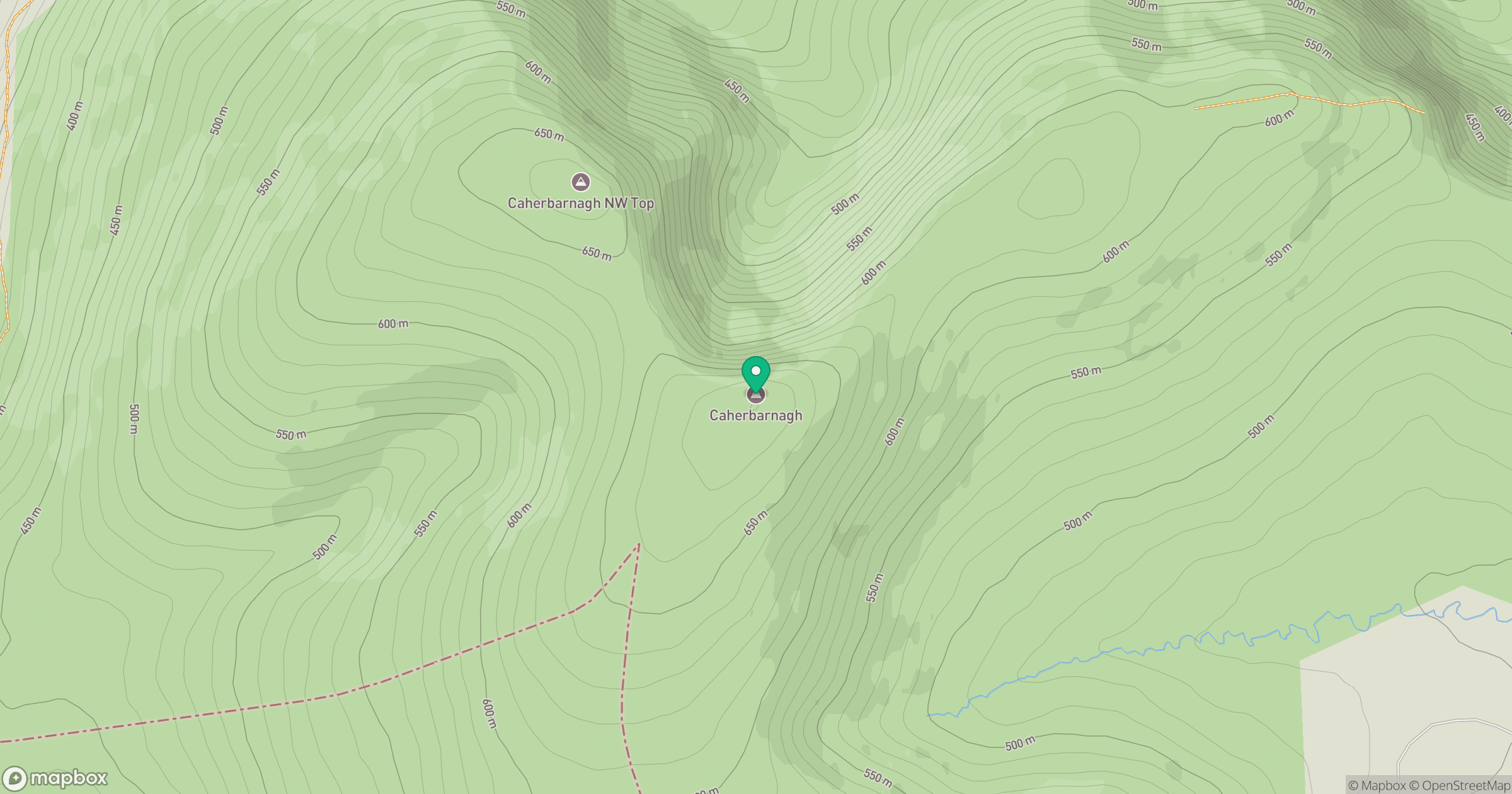
Grid reference: W191871
View on OpenStreetMapOpens a map in a new tab, centred on the hill.
No comments yet. Be the first.